Building intelligent applications for the real world.

Computer Scientist and Ph.D. in Geoinformatics. I apply software engineering, spatial data, algorithms, and AI to create tailored solutions that automate tasks and deliver real results for the people who use them.

Ph.D.Geoinformatics
10+ yearsProgramming
GeoAI & Computer VisionCurrent focus
Marcelo Galvão
Software Engineer Geospatial Technology
GIS + Spatial DataPostGIS · 3D · Mapping
Intelligent SystemsInteroperability · Vision · AI
01 — About

Software engineering with a geospatial mindset.

I hold a degree in Computer Science from the University of Brasília, an MSc in Geospatial Technologies (Erasmus Mundus), and a Ph.D. in Geoinformatics from the University of Münster, Germany. My specialties are software engineering, geospatial systems, digital cartography, and mobile applications — fields I've been passionate about since my undergraduate years and have been exploring through research and the development of practical solutions.

Throughout my career, I've worked on major technology projects such as the United Nations Renewable Energy Observatory, WAYTO — a research project focused on developing navigation systems — and GeoAR — high-precision, geographically aware augmented reality. Currently, I develop software solutions for the agricultural sector, integrating spatial data, artificial intelligence, computer vision, and mobile applications.

I have experience with a wide range of technical tools. I work with Java, Python, C#, JavaScript, Kotlin (Android), APIs, spatial databases (PostGIS), web and mobile applications, data science, and Unity 3D. Always integrating software engineering, spatial data, and intelligent methods to bring ideas to life and build everything from research prototypes to applications used in real operations.

Mobile ApplicationsComputer Vision3D & AR Geospatial SolutionsGeoAIGISDigital Cartography
02 — Projects

Software that integrates technology and geospatial data.

Take a look at some of my systems projects, or visit my GitHub for more details.

Cattle-Vision

Ongoing work

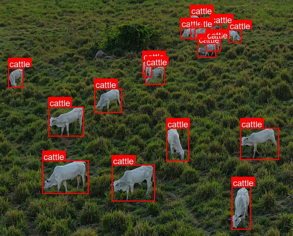
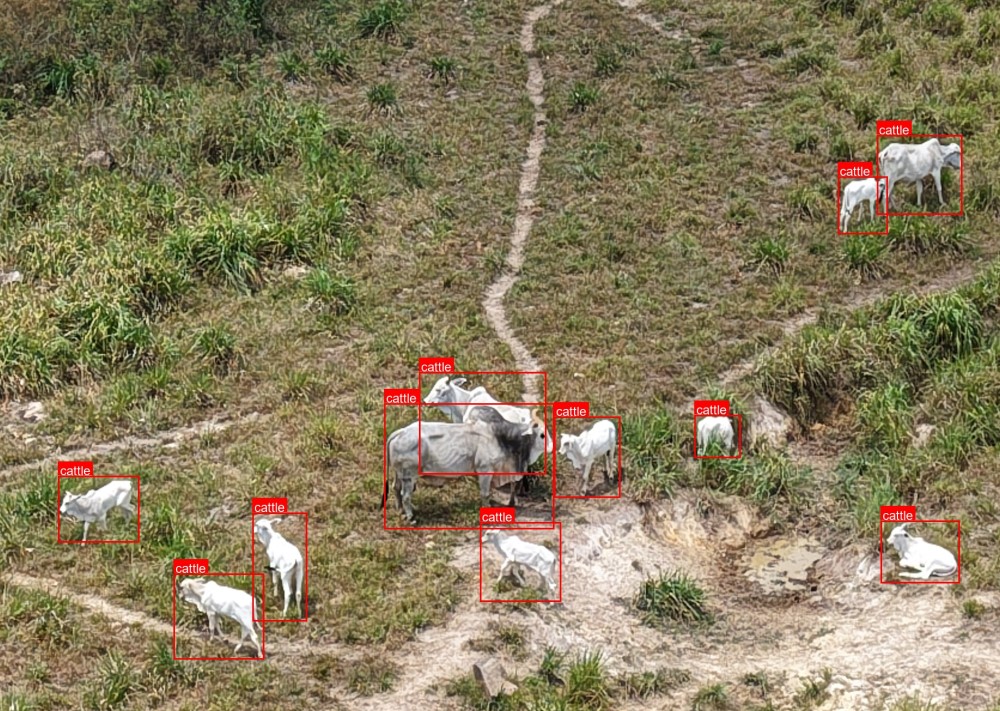
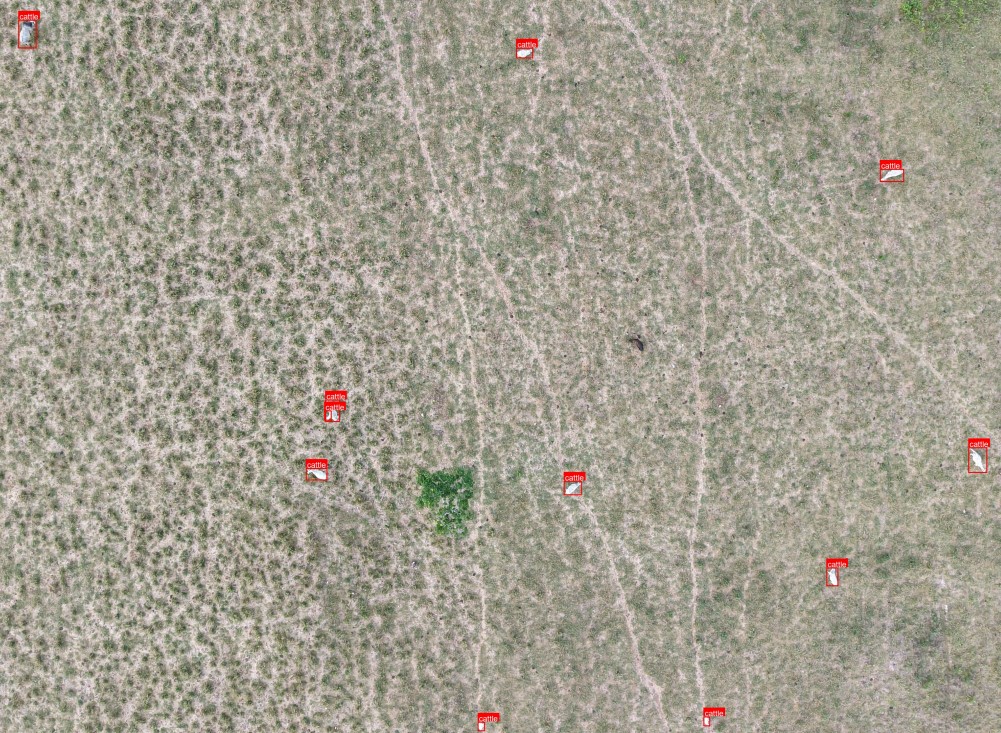
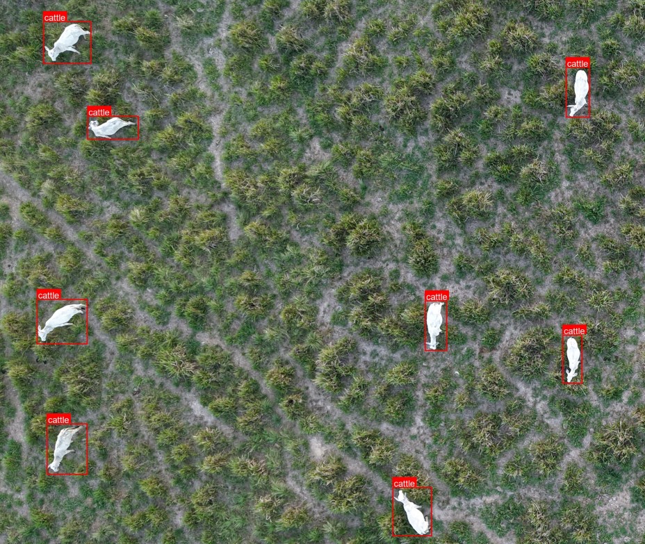
Cattle-Vision is a Computer Vision / GeoAI system for detecting and classifying cattle in drone imagery captured over a rural cattle farm.

The system uses aerial imagery, geospatial information, and Deep Learning to support automated inventory and monitoring of cattle and pastures.

With this system, farmers can know the exact location of their animals within hours. And answer questions like "How many calves were born in that lot?" or "What is the animal-to-area ratio in that pasture?"

PythonComputer VisionRemote SensingGIS

GeoAR

Research Project · TU Vienna

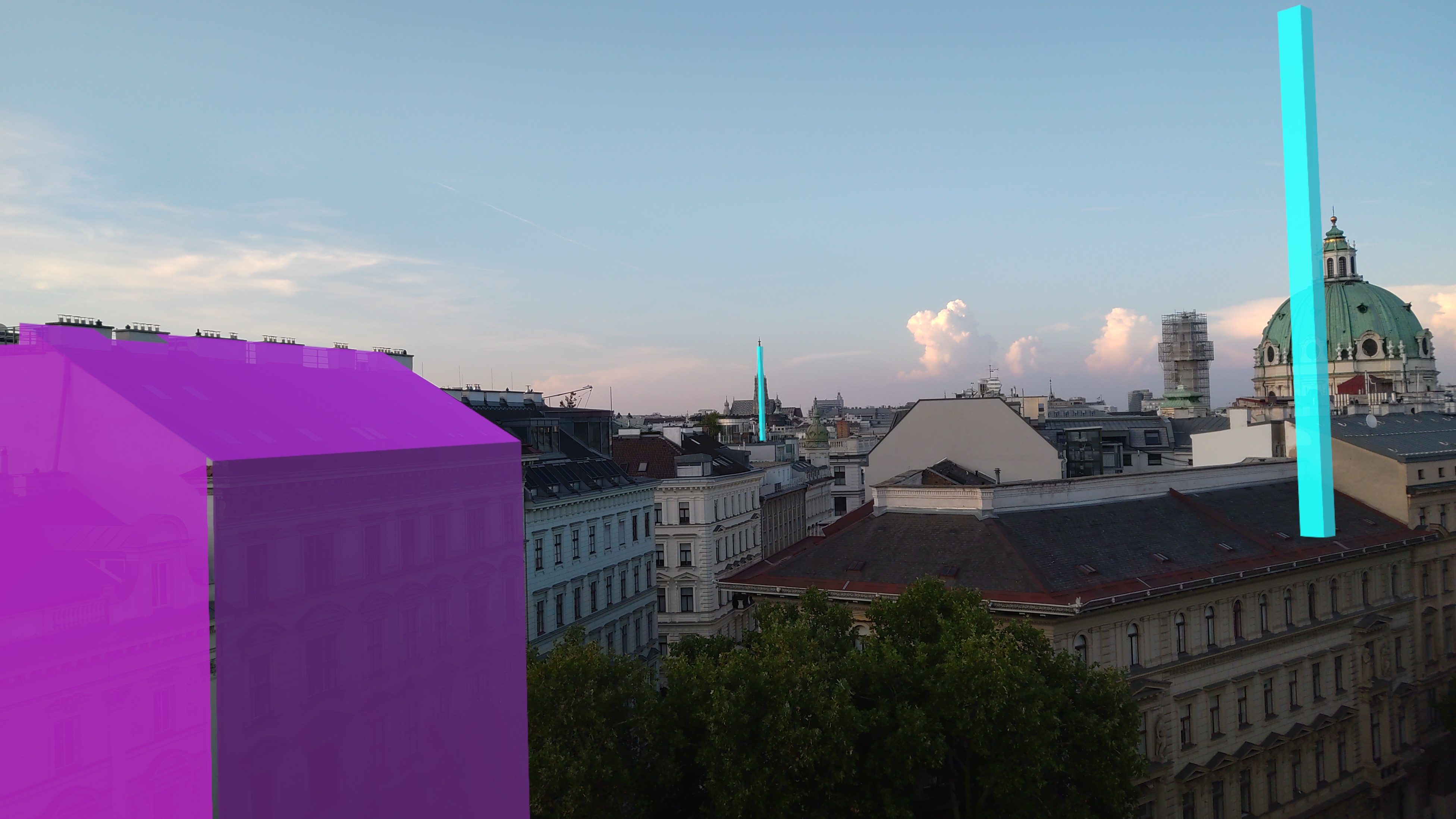
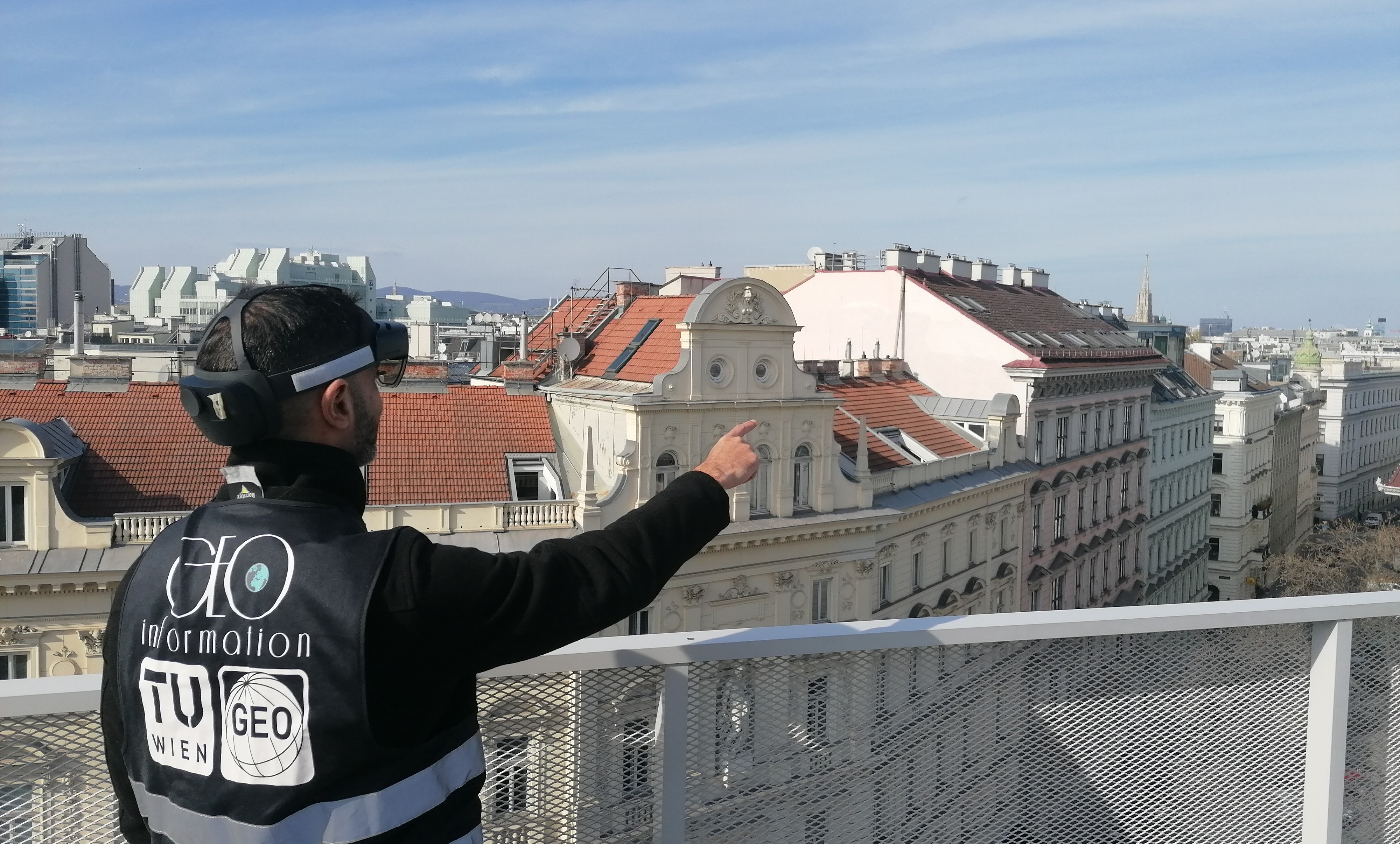
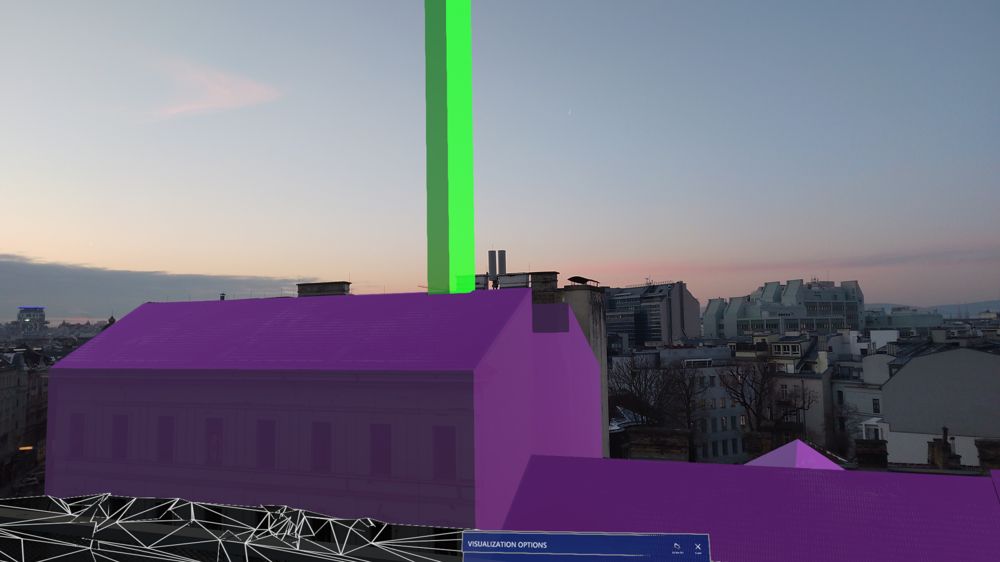
GeoAR is a geographically aware augmented reality application, developed during my postdoc at TU Vienna.

Built primarily for the Microsoft HoloLens 2, GeoAR is one of the available AR applications with the highest positioning accuracy in outdoor urban environments — capable of highlighting objects and buildings accurately even at distances of over 1 km.

GeoAR is available for free with a tutorial to start from scratch and demonstrating all features.

Tutorial
C#/.NET Unity 3d Android CityGML
03 — Professional Experience

Research experience, engineering mindset.

2022 — 2024
Geoinformation Researcher
TU Vienna · Department of Geodesy and Geoinformation

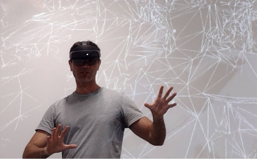
During my postdoc in Vienna, I led the Mixed-Reality Lab, focusing on Augmented Reality (AR) for outdoor environments, aiming to improve visualization accuracy and application usability. In this context, I designed and developed the GeoAR framework, integrating a C# (.NET) AR application, a Python API, a PostgreSQL database, an Android app, and the MQTT protocol. Beyond research and development, I taught courses in Computational Geometry, Software Engineering, GIS Implementation, and Mobile GIS.

Presenting the GeoAR framework to students
Presenting the GeoAR framework to students.
2016 — 2021
Geoinformatics Researcher
University of Münster · Institute for Geoinformatics

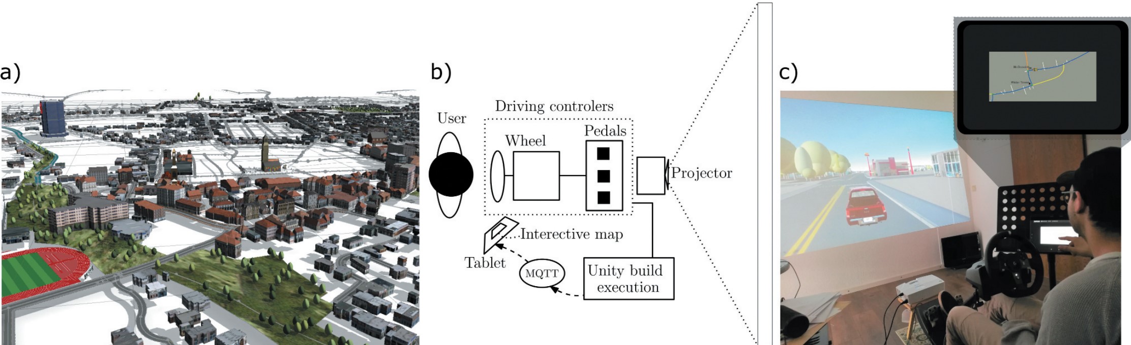
I worked within the WayTO project, funded by the European Union (Horizon 2020), which sought to innovate the concept of navigation systems. I developed systems encompassing cartographic generalization, computational geometry, optimization, and map usability. I also built research tools such as 3D city models and driving simulators to test navigation system prototypes. In addition, I was responsible for teaching programming and digital cartography courses. Following the research work, I earned a Dr. rer. nat. (Ph.D.) in Geoinformatics from the University of Münster, Germany, with the thesis "Schematic Maps for Navigation Systems".

WayTO project navigation system prototype
WayTO Research Project. a) 3D city model created with CityEngine and SketchUp. b) Hardware assembly of the driving simulator. c) A user navigating the virtual environment while using the navigation system prototype on a tablet. Image from Galvao et al. (2021)
2012 — 2014
IT & Communication Technician
United Nations Industrial Development Organization

At UNIDO, I worked as an ICT Technician at the Renewable Energy Observatory for Latin America and the Caribbean, developing and maintaining geoinformation systems for renewable energy projects. I also supported the development of a document management system (Alfresco) and was responsible for administering web servers on Red Hat Linux, as well as internal newsletters and product websites and portals.

04 — Expertise

My main work tools.

Software Engineering

Java · Python · C#/.NET · JavaScript · Kotlin · REST APIs · Web

Geospatial

GIS · PostGIS · PostgreSQL · Spatial Analysis · Computational Geometry · GeoJSON · 3D GIS

AI & Data

GeoAI · Computer Vision · OCR · Optimization · Statistical Analysis

3D & Visualization

Augmented Reality · Unity · 3D Programming · Cartographic Visualization · Interactive Maps

Languages Portuguese — Native English — Fluent German — Fluent Spanish — Fluent
05 — Research

Algorithms for Geospatial Visualization

My research focuses on algorithms and methods for geospatial visualization, cartographic generalization, navigation, and geographically aware augmented reality. I am the author of more than 10 papers published in international journals and conferences and, since 2024, I have served as a member of the editorial board of Cartography and Geographic Information Science.

Google Scholar
06 — Contact

Got a geospatial problem worth solving?

I'm interested in software engineering, GeoAI, computer vision, geospatial applications, and applied R&D.

CV